Get ready, Hurricane Erin could gain strength this weekend
Hurricane Erin is moving across the Atlantic with increasing strength, threatening the Caribbean with intense rains and dangerous storm surges.
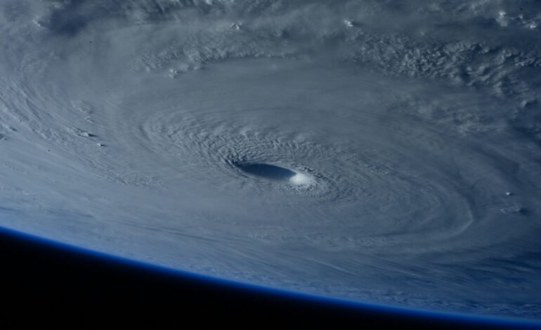
Photo of POT in Unsplash
The system that began as Tropical Storm Erin has become the first hurricane (Category 1) of the 2025 Atlantic season, with sustained winds of up to 75 mph (120 km/h).
Located hundreds of miles east of the Leeward Islands, Erin continues to move west-northwest, approaching the Caribbean. It is expected to intensify rapidly, possibly reaching Category 3 or major hurricane status. Although some experts predict it could even reach Category 4 status by next weekend.
Areas under surveillance
Tropical storm warnings have been issued for several Caribbean islands, including Anguilla, Barbuda, St. Maarten, St. Barthélemy, Saba, St. Eustatius, and St. Maarten. In Puerto Rico, the Antilles, and other nearby islands, heavy rains of up to 6 inches are expected, along with the risk of flooding and landslides.
Potential impacts
Although Erin is not expected to make direct landfall, it could cause:
- Massive waves of up to 15 feet in North Carolina and dangerous rip currents along the U.S. East Coast.
- Yocoastal flooding and erosion, especially in vulnerable areas like the Outer Banks of North Carolina.
Erin was named after forming near Cape Verde, the fifth named storm of the hurricane season, which is expected to be more active than usual. Erin already caused deadly flooding in West Africa before moving into the Atlantic.
For more stories like this, follow More Latin.
Sources: